Camera Location Scouting
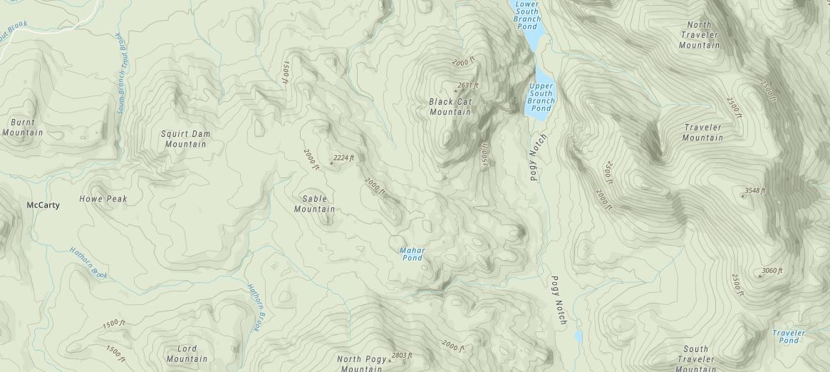
Out here in the Maine woods, putting trail cams (or my DSLR setups) in the right spot makes all the difference between empty cards and killer shots of bucks, moose, bears, whatever walks by. Forget wandering aimlessly; I start right in OnX Maps to spot the obvious funnels: saddles between ridges, benches along steep slopes, stream crossings that everything has to hit. Those big-picture pinches show up clear as day in the satellite and hybrid layers if you know what you are looking for.
Combine that with drone flights low and slow (staying legal, of course) to glass the canopy breaks—looking those faint dark lines where game trails cut through the woods and openings. Then I pull up the free LIDAR hillshade to take a closer look.

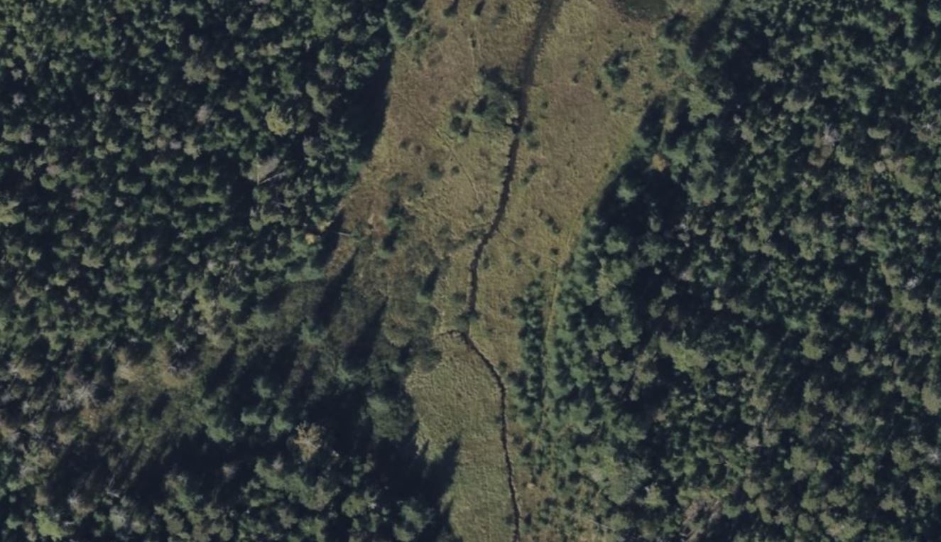
That tool is really useful—it removes the trees and shows the actual ground: old tote roads, subtle contours animals follow, every little dip and rise they use to move without wasting energy. Animals are lazy by nature, so they love old twitch trails that cross water—these narrow, historic paths often provide the easiest way over streams or brooks without climbing steep banks. OnX and LIDAR make those faint crossings stand out, and I've found some of my best trail cam spots right where an old tote or twitch trail hits the water. Another thing to watch for: nearby clear-cuts or timber cuts that are close to each other. There are almost always animal trails connecting those food sources—deer and moose will move between them for browse, and the trails between cuts show up as darker lines on satellite or drone views, especially when you overlay the topo.

High-use trails often lead right to swamps and marshes. Moose especially love these wet spots for feeding on water plants and browsing the edges, but deer and bear use them for water, cover, and easy travel. On LIDAR and topo layers, look for trails dropping from ridges or benches into the wetland, usually following the drier ground that leads in or out. Satellite picks up darker, worn vegetation where animals keep pushing through, and drone flights show those paths snaking from the upland woods to the marsh edge. I place cams on these entry/exit trails—where animals move from thick cover to open feeding—especially early season or when bugs push them to the water.
One of the best times to do all this digital scouting is during the winter months. It's a slow time of year with not much going on outdoors, so I spend those days inside planning and marking spots on the maps. That way, when things start to thaw and the season ramps up, I'm already set and can hit the woods running without wasting time figuring it out later.
Boots on the ground is the final step. I hike in, look for that 20-30 yard stretch where the trail squeezes between blowdowns or ledges, maybe a slight rise so the cam catches faces and racks clean. Mount them 3-4 feet up, face north to avoid glare, and let the woods do the rest. With OnX scouting the big picture, drone confirming sign, and LIDAR showing the terrain, I'm spending way less time in dead spots and way more time pulling cards full of Maine wildlife. The mountains don't give up easy, but this combo sure helps tip the odds.


